 |
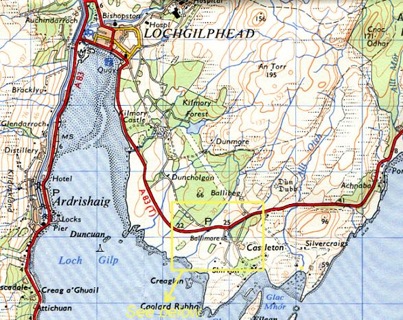
| Above: A recent map of Lochgilphead, Argyll showing the location of Castleton and Lingerton. |
A Brief History of Lochgilphead
as it relates to the McKechnie family history.
The Town of Lochgilphead
This brief summary of Lochgilphead's history is intended as a background to the McKechnie family history. It therefore concentrates on items considered relevant, and should not be regarded as a comprehensive history of the town or district.
Lochgilphead is situated at the head of Loch Gilp, a sealoch extending north from Loch Fyne. Until the 19th century, Lochgilphead was a small fishing village but with the opening of the Crinan Canal in 1801, it grew in popularity as a holiday centre for the wealthy of the west of Scotland. Lochgilphead went through a second expansion when it was chosen as the district headquarters for Argyll and Bute District as part of the 1975 reorganisation of local government in Strathclyde Region.
Kilmory Castle is just outside Lochgilphead, and since 1975 has housed the headquarters of the Argyll and Bute council.
|
| Above: A recent map of Lochgilphead, Argyll showing the location of Castleton and Lingerton. |
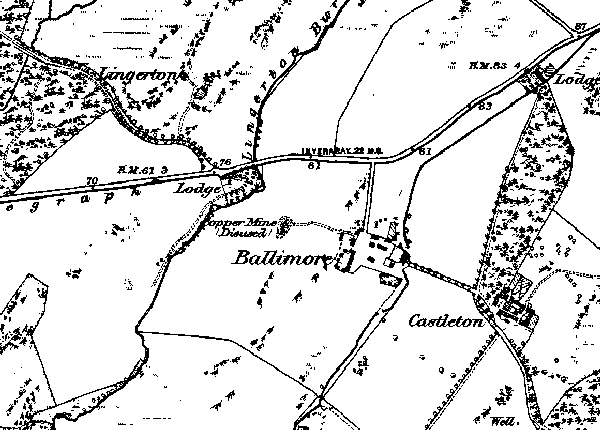
| Below: This extract from the 1873 1:10,000 Ordnance Survey map shows Castleton, where John McKechnie lived at no.4 with his family in 1851, and Lingerton, where John's father Dugald lived at the time of his marriage in 1788. Both are on the Kilmory estate, just east of Lochgilphead. |
 |
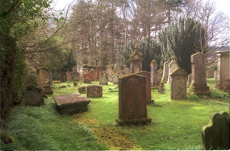
A track runs SSE from Kilmory castle, and where it meets the main road is a hose called Red Lodge. Beside the house is a path leading to a walled graveyard, long since out of use but well maintained.
 |
 |
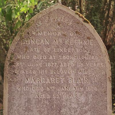 |
| The gravestone of James McKechnie (d. 1805), Dugald McKechnie (d. 1893), and their wives. | The peace of Kilmory graveyard. A number of McKechnie gravestones are to be found in the far left corner, near the gate. | The gravestone of Duncan McKechnie of Lingerton (d. 1877) and his wife Margaret. |
Lingerton was a small farming settlement about two miles from Lochgilphead, just north of the Inverary road. It is likely to have been the type of multiple-tenancy farm once common in the highlands.
In 1672, Robert and Duncan Stewart were tenants of Lingerton. In 1685 Duncan Campbell, Duncan McKarran and John Campbell were all tenants, and they were declared rebels and their animals forfeit by a court convened by the Marquis of Atholl.
In the valuation roll of 1751, Lingerton was owned by Patrick Campbell and was a Wadset, a legal term meaning that it was in the hands of creditors who could draw on income from the property in payment of debts. In 1849, Lingerton was bought by Sir John Plowett Orde Bt., of Kilmory.
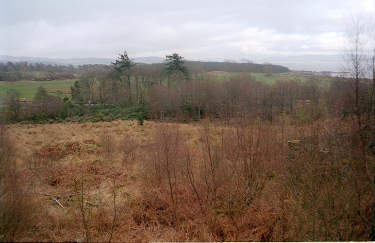
In the 1881 census, the only mention of Lingerton is Lingerton Lodge, which still exists on the main road, so it is probable that by then the farm had been abandoned. Since then, the site has been planted under forest, the trees grown to maturity, and felled. Today (2001) the remains of the small building at the end of the track exist up to low roof level, but the main site is entirely flattened.
 |
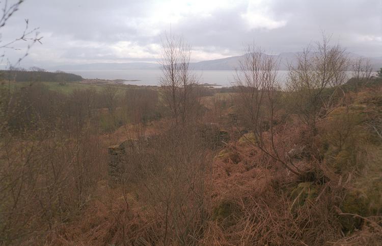 |
| The site of the Lingerton farmstead as it is today (2001). The main buildings were on the flat land in the middle distance, and the ruin of a cottage or outbuilding can be seen in the right foreground. | The view from Lingerton over Loch Gilp, and the ruins of a rough stone-built building. It comprised two rooms, the nearer one 10' x 10' with a window, the other 10' x 30' with a door. |
Castleton house was built in about 1840. For some of its history it was also known as Shirvan, and was owned by the Graham-Campbells. In about 1965 the estate was sold. Castleton Farm is nearby. Down the hill from the farm was a row of five cottages, recently demolished to make way for a new house.
At the time of the 1841 census, John McKechnie and family lived at number 4 Castleton, which was probably on the site of the recently-demolished cottages.
 |
||
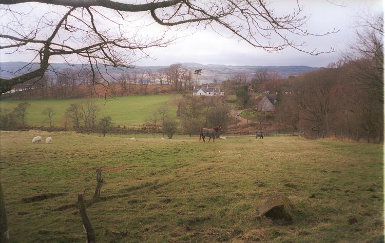
| . | A view across the fields to Ballimore, from Castleton farm.. | . |